These days, we expect studies regarding climate change to illustrate some distressing outcomes. Droughts are more widespread, wildfires more frequent, hurricanes more powerful.
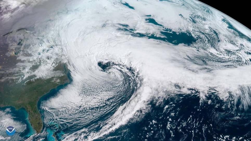
But results from a recent study on the potential for increased intensity and frequency of nor’easters — storm events that arise during the Atlantic Ocean’s cold season — leaned more toward the moderate end of the spectrum.
It looked like a bright spot on the climatic horizon. Then a “however” appeared in the data in the form of Northern Chesapeake Bay and Delaware Bay.
“Overall, we did see some evidence of a slight decrease for counties on the open Atlantic Ocean versus an increase in those counties further up in the big estuaries, like Delaware Bay and Chesapeake Bay, where the storms are tracking further inland.” — William Pringle, Argonne coastal and geophysical scientist
“We found a decrease in extreme coastal sea levels that occur on average every 1-3 years during the cool season months, in many parts of the Northeast,” said William Pringle, a coastal and geophysical scientist with the U.S. Department of Energy’s (DOE) Argonne National Laboratory.
“But in the upper parts of the Chesapeake and Delaware Bay regions, we found an increase in strong inland tracking storms causing higher water levels that could cause more damage along that part of the coast.”
Pringle led an Argonne research team that models nor’easters. Technically known as extratropical cyclones, the storms affect the Northeast United States from Massachusetts to North Carolina, and from November to March, producing storm tides and surges that can cause serious flooding.
The team wanted to determine whether climate change would play a significant role in the evolution of these storms and the surges that they might generate over the next several decades. Research results could help cities and regions along the East coast develop strategies for limiting damage caused by associated events.
The study, published in the journal Earth’s Future, was a follow-up study of work conducted for AT&T to understand changes to winter and summer storms all across the U.S. Argonne climate modeling expertise and supercomputing resources helped the telecommunications giant develop a tool to help project the impacts of climate change on its infrastructure.
What sets this new study apart from similar studies is the combination of several Argonne-developed, high-resolution model projections. Like the one used for AT&T, some of the projections have already been applied to future drought, wildfire, hurricanes and other weather-related events.
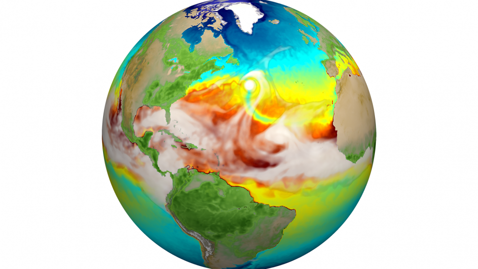
And where many global climate models provide a broad stroke view of large areas, they do not capture the dynamics that drive more localized weather patterns. Using DOE supercomputers, Argonne’s researchers ran regional climate and coastal ocean models with much higher resolutions. The combination helped them capture a more detailed assessment of cyclone frequencies and intensities, and associated storm surges, Pringle noted.
“This is also the first time that we have used a high-resolution climate model plus a high-resolution coastal flood model to do these calculations,” said Rao Kotamarthi, one of Argonne’s leading experts in climate modeling. “Our climate calculations run at a resolution of 12 km, which then drives the coastal model at a very high resolution of 50 meters.”
A resolution of 12 km provides far more detail than traditional 100 km climate models. And models with a 50-meter resolution, while very computationally expensive, revealed more localized features that were previously unattainable.
In fact, they were able to determine which areas along the coast would get higher or lower storm tides on a county by county basis.
“The paper describes, for example, what would happen in Sussex County in Boston,” added Kotamarthi. “So, as we were looking closely at regions along Delaware and the Chesapeake Bay area, we were able to pinpoint this increase in storm tide flooding.”
Another factor that set this study apart was the consideration of coastal ocean physics not typically used in this type of study. For example, where researchers traditionally focused just on storm surge — the wall of water pushed shoreward by the storm — Pringle’s team focused on surge plus the astronomical tide — the daily rise and fall of sea level along the coast.
“We ran simulations a number of times with different random timings between what the normal tide would be and the weather event,” said Pringle. “That would produce different peaks, depending on if it lined up with high tide or low tide.”
Because the tides are quite large in this region, the size of the tide could be similar to or even larger than the magnitude of the surge. This could create a stronger and possibly dangerous storm tide depending on when they aligned.
The regional climate model also developed the projections of atmospheric conditions, like winds and pressure, which play a large role in weather patterns that could decide the intensity of such storms. The coastal model, at a resolution of 50 meters, used this information to capture a more detailed picture of local phenomena, like storm tides and coastal water levels.
Depending on where you are in the world, weather is affected by local topographies, among many other factors. For example, Lake Michigan impacts the wind patterns around Chicago in a different way than locations to the east of the lake, notes Jiali Wang, an Argonne atmospheric and Earth scientist and a member of the study’s team.
But to understand that distinction properly requires the kind of resolution that the Argonne model provides.
“If you use grid cells that are 100 km by 100 km over Illinois or the Midwest, you only get a few grid cells, which only gives you projections that are smoothed out over a large region,” said Wang. “At 12 km, the much smaller grid cells let you zoom in and see the local phenomena at work.”
In an ongoing project, the team is calculating the climate projections at an even finer scale of 4 km, which allows them to represent the physics in greater detail.
Beyond that, the tide-weather timing ensemble gave the researchers a better idea of the uncertainty of projections in the extreme water level changes. In those places where uncertainties occur, the team will go back and do more model simulations to understand some interaction they might be missing.
For example, models might have to be adjusted for expected sea level rise created by the effects of global warming. According to the team’s paper, the sea level rise may prove a bigger problem than changes in storm tides by the end of the century.
While a little nuanced, noted Pringle, the differences in peak water levels based on the winter storm climatology was generally small compared to the differences we might expect from sea level rise.
“Overall, we did see some evidence of a slight decrease for counties on the open Atlantic Ocean versus an increase in those counties further up in the big estuaries, like Delaware Bay and Chesapeake Bay, where the storms are tracking further inland,” he said.
On the whole, the statistics for these extratropical storms are not changing so significantly as to suggest a higher probability of a large surge event in the future versus now.
Good news?
“It’s neutral news,” Pringle quipped. “But we shouldn’t treat it complacently.”
This research was published under the title “Projected Changes to Cool-Season Storm Tides in the 21st Century Along the Northeastern United States Coast.” Authors include Pringle, Wang and Kotamarthi of Argonne; and Keith J. Roberts of Stony Brook University in New York.
The project received funding through Argonne’s Laboratory Directed Research and Development program and support from AT&T Services Inc., under a Strategic Partnership Project agreement.
Computational resources used for this research included those from Argonne’s Laboratory Computing Resource Center, the Argonne Leadership Computing Facility and the National Energy Research Scientific Computing Center at DOE’s Lawrence Berkeley National Laboratory. ALCF and NERSC are DOE Office of Science user facilities.
The Argonne Leadership Computing Facility provides supercomputing capabilities to the scientific and engineering community to advance fundamental discovery and understanding in a broad range of disciplines. Supported by the U.S. Department of Energy’s (DOE’s) Office of Science, Advanced Scientific Computing Research (ASCR) program, the ALCF is one of two DOE Leadership Computing Facilities in the nation dedicated to open science.
Argonne National Laboratory seeks solutions to pressing national problems in science and technology. The nation’s first national laboratory, Argonne conducts leading-edge basic and applied scientific research in virtually every scientific discipline. Argonne researchers work closely with researchers from hundreds of companies, universities, and federal, state and municipal agencies to help them solve their specific problems, advance America’s scientific leadership and prepare the nation for a better future. With employees from more than 60 nations, Argonne is managed by UChicago Argonne, LLC for the U.S. Department of Energy’s Office of Science.
The U.S. Department of Energy’s Office of Science is the single largest supporter of basic research in the physical sciences in the United States and is working to address some of the most pressing challenges of our time. For more information, visit https://energy.gov/science.


